
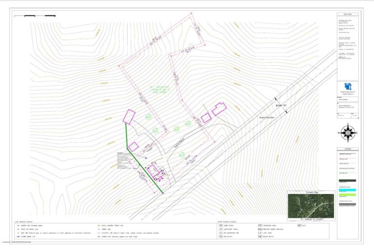
Austin's zoning code changed substantially in 2025. If the site plan you're working from cites pre-HOME impervious cover limits, pre-HOME building coverage percentages, or doesn't reference your property's watershed classification — it's working from a framework that no longer fully applies.
The City Council’s HOME (Home Options for Middle-income Empowerment) ordinance amendments took effect in phases starting in 2024, with Phase 1 changes for duplex and multi-unit residential applications accepted beginning June 16, 2025. The amendments touched impervious cover limits, building coverage percentages, lot size minimums, and how many housing units are allowed on single-family zoned property. Single-family residential use under Subchapter F continues under its prior framework in most respects — but a property that’s part of a lot split, a duplex conversion, or any project touching the HOME-amended categories needs the current standard, not last year’s.
Layered on top of HOME: Austin’s watershed classification system, which determines impervious cover limits independently of zoning district — and the Residential Design and Compatibility Standards (commonly called the “McMansion” ordinance), which constrain the buildable area on a lot based on its size and the surrounding neighborhood’s scale, regardless of what the base zoning would otherwise allow.
We draft Austin site plans against the current HOME framework, the applicable watershed impervious cover limit, and Compatibility Standards where they apply — not a generic Texas template or a pre-2025 Austin reference.
- Free revisions if Austin Development Services returns comments
- 24-hour turnaround for most residential plans
- Fixed price — $89 to $249
What Changed in Austin — And Why a Generic Site Plan Misses It
Impervious cover limits come from your watershed classification, not just your zoning district — and watershed limits vary dramatically. Austin’s Land Development Code ties impervious cover restrictions to watershed classification under Chapter 25-8. The Barton Springs Zone — subject to the Save Our Springs Ordinance — caps impervious cover at roughly 15-25%, among the most restrictive in the city. Water Supply Rural watersheds allow around 20-25%. Water Supply Suburban watersheds allow 25-40%. A property’s watershed classification is independent of its zoning district — two properties with identical SF-3 zoning can have very different impervious cover limits if they sit in different watersheds. A site plan that applies a generic “Austin allows X% impervious cover” figure without checking the specific watershed classification is applying the wrong number more often than not.
The HOME amendments changed impervious cover and building coverage for SF-1 and related districts. Under the HOME amendments, maximum building coverage for certain uses is 40%, and maximum impervious cover is 45% — an increase from pre-HOME regulations for SF-1 zoning. For SF-1, SF-2, and SF-3 districts more broadly, maximum impervious cover is determined by the base zoning district under the current framework, with maximum building coverage at 55% in some configurations. Garages and carports continue to count toward both impervious cover and building coverage — a detail that matters when a homeowner is calculating how much “room” they have left for an addition or accessory structure after the existing garage is factored in.
ADU rules changed too — and the math involves two separate caps that both apply. Austin permits ADUs in all single-family zones. Detached ADUs require a 4-foot side setback and 10-foot rear setback. The maximum size is the lesser of 1,100 square feet or 15% of the lot area — meaning on a smaller lot, 15% of the lot area may be the binding constraint well before 1,100 square feet becomes relevant. No additional off-street parking is required for ADUs under current rules. Critically, the ADU’s footprint counts toward the lot’s overall impervious cover limit — which means in a restrictive watershed, the ADU size that “fits” under the 1,100 sq ft / 15% calculation might still not fit once the impervious cover limit for that specific watershed is applied on top of it. Two separate limits, both binding, and the more restrictive one controls.
Heritage trees and protected trees are different categories with different consequences. Austin’s tree protection regulations distinguish heritage trees — 24 inches or greater DBH — from protected trees — 19 inches or greater DBH (8 inches or greater in Hill Country Roadway zones). Heritage trees cannot be removed without a variance from the Land Use Commission, and removal requires 3:1 replacement mitigation plus payment into the Tree Mitigation Fund. Protected trees require a tree permit for removal, with 1:1 replacement mitigation. The Critical Root Zone — the area within a radius of half the tree’s canopy spread, or 10 feet from the trunk, whichever is greater — defines the protection boundary for construction purposes. A site plan that identifies “a large tree” without determining whether it crosses the 19-inch or 24-inch DBH threshold is missing the distinction that determines whether removal requires a permit or a Land Use Commission variance.
Residential Design and Compatibility Standards — the “McMansion” ordinance — can constrain buildable area regardless of zoning. These standards define the acceptable building area for a lot based on lot size and the scale of surrounding development, intended to keep new construction, remodels, and additions compatible with established neighborhood character. This is a separate layer from zoning district regulations and from watershed impervious cover limits — a project can comply with both of those and still need to address Compatibility Standards’ building area limitations, particularly for additions and new construction in established single-family neighborhoods.
Small projects under specific thresholds may qualify for a Site Plan Exemption — but the thresholds are exact, and exceeding them by even a small margin disqualifies the project. Generally, a project must not exceed 5,000 square feet of impervious cover and 10,000 square feet of construction area (limits of construction) to qualify as a small project with reduced fees, shorter review times, and no notification requirement. Projects that are anywhere near an environmentally sensitive area — protected trees, watersheds, slopes — are likely to require full site plan review even if they’re under the size threshold, if the project alters drainage patterns or increases impervious cover beyond what’s otherwise allowed. A site plan that doesn’t calculate the project’s impervious cover and construction area against these exact thresholds can result in a project assumed to be exemption-eligible turning out not to be — sometimes by a margin of a few square feet.
What Real Austin Correction Comments Say
“Impervious cover calculation does not reflect applicable watershed classification. Property located within Water Supply Suburban watershed — maximum impervious cover 25-40% per Chapter 25-8 depending on specific subclassification. Resubmit with watershed-specific impervious cover documentation.”
We determine the specific watershed classification for the parcel — Barton Springs Zone, Water Supply Rural, Water Supply Suburban, or other — and apply that watershed’s impervious cover limit, not a generic citywide figure.
“Proposed ADU footprint (1,100 sq ft) exceeds 15% of lot area for this parcel. On a lot of this size, 15% of lot area is the binding constraint, not the 1,100 sq ft absolute maximum. Resubmit with revised ADU footprint.”
We calculate both the 1,100 sq ft absolute cap and the 15%-of-lot-area cap for every ADU, and apply whichever is smaller — which on smaller lots is frequently the percentage-based figure, not the flat number.
“Tree identified within proposed disturbance area measures 22 inches DBH. Protected tree status (19 inch threshold) applies — tree permit required for any work within Critical Root Zone. Resubmit with Critical Root Zone boundary shown and tree permit referenced.”
We measure tree DBH against both the 19-inch protected tree threshold and the 24-inch heritage tree threshold, and document the Critical Root Zone — half the canopy spread or 10 feet from trunk, whichever is greater — for any tree within the disturbance area.
“Project impervious cover and construction area exceed Site Plan Exemption thresholds (5,000 sq ft impervious cover / 10,000 sq ft construction area). Full site plan review required. Resubmit as full site plan application.”
We calculate impervious cover and construction area against the exact exemption thresholds before assuming a project qualifies for the reduced-review small project pathway.
“Residential Design and Compatibility Standards apply to proposed addition. Building area shown exceeds acceptable building area for this lot under Compatibility Standards. Resubmit with revised building area or Compatibility Standards analysis.”
For additions and new construction in established single-family neighborhoods, we check whether Compatibility Standards constrain the buildable area independent of zoning district regulations.
“Setback dimension shown measured to foundation wall. Furthest projection of structure required for setback measurement. Resubmit with corrected dimensions.”
Standard furthest-projection measurement requirement — eave, overhang, or roof projection — applied on every Austin plan.
What Every Austin Site Plan We Deliver Includes
| Element | Why It Matters Under Austin’s Current Framework |
|---|---|
| Property lines from Travis County recorded plat | Legal dimensions, not GIS approximations |
| Watershed classification identification | Barton Springs Zone, Water Supply Rural, Water Supply Suburban, or other — determines applicable impervious cover limit under Chapter 25-8, independent of zoning district |
| Impervious cover calculation per watershed limit | Existing and proposed hardscape totaled against the specific watershed’s limit, not a generic citywide figure |
| HOME-current building coverage and impervious cover figures | SF-1/SF-2/SF-3 building coverage and impervious cover per current post-HOME standards |
| ADU dual-cap calculation — 1,100 sq ft and 15% of lot area | Both limits calculated; smaller figure applied, which is frequently the percentage-based figure on smaller lots |
| Tree DBH measurement against 19″ and 24″ thresholds | Protected tree (19″+) vs. heritage tree (24″+) status determined; Critical Root Zone documented for trees within disturbance area |
| Site Plan Exemption threshold check | Impervious cover and construction area calculated against the 5,000 sq ft / 10,000 sq ft exemption thresholds before assuming exemption eligibility |
| Residential Design and Compatibility Standards check | Buildable area verified against Compatibility Standards for additions and new construction in established neighborhoods |
| Setbacks measured to furthest projection | Eave, overhang, roof projection — not foundation |
| North arrow, engineering scale, legal description | Required on every sheet |
Real Austin Case Study — ADU Footprint Exceeded the Lot-Area Cap, Not the Absolute Cap
Project: Detached ADU, single-family zoned lot in Austin
What the homeowner submitted: A site plan showing a 1,100 square foot detached ADU — designed to the absolute maximum the homeowner understood Austin to allow.
What came back: “Proposed ADU footprint (1,100 sq ft) exceeds 15% of lot area for this parcel (lot area: 6,200 sq ft; 15% = 930 sq ft). Maximum ADU size is the lesser of 1,100 sq ft or 15% of lot area. Resubmit with revised footprint not exceeding 930 sq ft.”
The actual problem: The 1,100 square foot figure is real — but it’s a ceiling, not a guarantee. On this lot, 15% of the 6,200 square foot lot area worked out to 930 square feet, well under 1,100. The homeowner had designed to the absolute maximum without realizing the percentage-based calculation would control on a lot of this size.
What we did when the homeowner came to us: Calculated 15% of the actual lot area (930 sq ft) and confirmed it was the binding constraint. Revised the ADU footprint to 920 square feet — under the cap with a small margin. Checked the watershed classification for the parcel (Water Supply Suburban) and confirmed the revised ADU footprint, combined with the existing house and driveway, kept total impervious cover within that watershed’s limit. Verified no protected or heritage trees fell within the revised footprint’s disturbance area.
Outcome: The revised plan, with the ADU sized to the lot-area-based cap and impervious cover verified against the watershed limit, cleared review on the next submission cycle. The 180 square foot reduction from the original design was identified before construction documents were finalized.
Pricing
| Service | Price |
|---|---|
| Basic Site Plan — property lines, setbacks, existing/proposed structures, north arrow, scale | $89 |
| Enhanced Plan — adds watershed-specific impervious cover calculation, easements, utility locations | $149 |
| Premium Plan — adds ADU dual-cap calculation, tree DBH and Critical Root Zone documentation, Compatibility Standards check, Site Plan Exemption threshold verification | $249+ |
✅ Free revisions if Austin Development Services returns comments
✅ 24-hour turnaround for most residential plans
✅ No survey required for most projects — we use Travis County recorded plats and GIS
✅ Watershed classification checked on every order
FAQs — Austin Site Plans
Watershed classification is determined by location under Austin’s Land Development Code Chapter 25-8 and isn’t always obvious from the address alone — it’s independent of zoning district. We check the specific watershed classification for your parcel — Barton Springs Zone, Water Supply Rural, Water Supply Suburban, or other classification — as part of the drafting process, since this determines the applicable impervious cover limit, which can range from roughly 15% in the most restrictive zones to 40% in less restrictive ones.
The maximum is the lesser of 1,100 square feet or 15% of your lot’s area. On larger lots, the 1,100 sq ft figure typically controls. On smaller lots, 15% of lot area can be significantly less than 1,100 sq ft and becomes the binding limit instead. We calculate both figures for your specific lot and apply whichever is smaller — and also check that the resulting ADU footprint, combined with your existing impervious cover, stays within your watershed’s impervious cover limit.
It depends on the impervious surface impact. El Paso requires a Stormwater Management Plan or Drainage Report for projects that affect impervious surface area — which includes most garages, additions, and ADUs that add roof area or hardscape. A small shed with minimal impervious impact may not trigger this requirement, while a detached garage with an extended driveway likely will. We assess the impervious surface impact for your specific project and include drainage documentation when it’s required.
Yes, significantly. Protected trees are 19 inches or greater DBH (8 inches in Hill Country Roadway zones) and require a tree permit for removal with 1:1 replacement mitigation. Heritage trees are 24 inches or greater DBH and cannot be removed without a variance from the Land Use Commission, with 3:1 replacement mitigation plus a Tree Mitigation Fund payment. The difference between these categories significantly affects project feasibility and timeline if the tree is within your construction area. We measure DBH against both thresholds and document the Critical Root Zone for any qualifying tree within the disturbance area.
It depends on whether your project’s impervious cover and construction area fall under the exemption thresholds — generally 5,000 square feet of impervious cover and 10,000 square feet of construction area (limits of construction) — and whether the project is near an environmentally sensitive area. Projects that alter drainage patterns or increase impervious cover near protected trees, watersheds, or slopes often require full site plan review even under these thresholds. We calculate your project against the exact thresholds before assuming exemption eligibility — exceeding the threshold by even a small margin disqualifies the project from the reduced-review pathway.
HOME (Home Options for Middle-income Empowerment) is a set of zoning code amendments that took effect in phases, with Phase 1 changes for duplex and multi-unit residential applications accepted beginning June 16, 2025. The amendments affect impervious cover limits, building coverage percentages, and how many housing units are allowed on single-family zoned property — primarily for duplex, two-unit, and three-unit residential uses. Standard single-family residential use under Subchapter F continues under its prior framework in most respects, but any project involving a lot split, multi-unit configuration, or other HOME-amended category needs the current post-2025 standards. We verify which framework applies to your specific project type.
The Residential Design and Compatibility Standards — informally called the “McMansion” ordinance — define the acceptable building area for a lot based on its size and the scale of surrounding development, to keep new construction and additions compatible with established neighborhood character. This applies independently of your zoning district’s regulations and your watershed’s impervious cover limit — a project can satisfy both of those and still need to address Compatibility Standards for the proposed building area. We check whether Compatibility Standards apply to your addition or new construction project and verify the proposed building area against them.
Other Texas Cities We Serve
Dallas | Fort Worth | Houston | San Antonio | El Paso | Plano | Frisco | Arlington | McKinney | All Texas Site Plans
Also serving: Sacramento | Jacksonville | Raleigh | Fort Lauderdale | Durham
Don’t see your city? We cover all 50 states. Enter your address at checkout.
Project Types We Cover
Official Austin Permit Resources
- Austin Development Services Department — Permits, site plans, plan review. Visit austintexas.gov/development-services
- Austin Site Plans, Exemptions, and Corrections — Site Plan Exemption thresholds, current submittal requirements: austintexas.gov/siteplans
- HOME Amendments — Current post-2025 zoning amendments for impervious cover, building coverage, and unit allowances: austintexas.gov/development-services/home-amendments
- Austin Land Development Code, Chapter 25-8 — Watershed protection, impervious cover limits by watershed classification
- City Arborist / Tree Ordinance — Protected tree (19″+ DBH) and heritage tree (24″+ DBH) standards, Critical Root Zone definitions
- Residential Design and Compatibility Standards — “McMansion” ordinance building area limitations
- Travis County Property Records — Recorded plats and legal descriptions
- FEMA Flood Map Service Center — Flood zone and panel lookups: msc.fema.gov
Based on the City of Austin’s Land Development Code, HOME ordinance amendments (Phase 1, effective June 16, 2025), Chapter 25-8 watershed protections, and Development Services submittal standards as of June 2026.