
A driveway permit site plan is one of the lighter residential permit drawings — until the property is a corner lot, the curb cut is near an intersection, or the new driveway pushes the lot's impervious coverage past the zoning limit. We check all three before drawing anything. From $89.
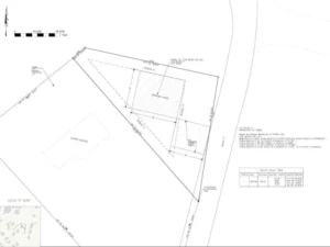
The homeowner wanted a two-car garage. The permit application looked simple enough — a few forms, a structural drawing from the contractor, and a site plan. The site plan went in showing the garage footprint, dimensions to the property lines, and not much else.
Three weeks later: correction notice. The total floor area ratio for the property now exceeds the zoning district’s maximum. The existing house, the proposed garage, and the finished basement square footage that the homeowner didn’t know counted toward FAR pushed the number over. Resubmit with a corrected floor area calculation.
Floor area ratio. Most homeowners have never heard the term. It shows up in fewer jurisdictions than lot coverage — but in the ones where it applies, missing it on a garage permit application is exactly the kind of thing that adds a month to a project that should have been approved in a week.
Attached Garage vs. Detached Garage — Two Different Site Plan Problems
Most driveway permits move quickly. The site plan requirement is real but the drawing itself is straightforward on a standard interior lot — show the lot, show the house, show where the driveway goes, label the curb cut width, note the setback from the property line. Done.
Where driveway permits stall is the same place fence permits stall on corner lots: the sight-line triangle. A clear zone at or near an intersection where no permanent structure, fence, wall, or landscaping above a certain height is allowed to obstruct a driver’s view of cross traffic. The driveway can’t start inside it. The curb cut can’t be positioned where it puts the driveway approach inside it. And the plan has to show it.
On a standard mid-block interior lot, none of this is an issue. On a corner lot, or on any lot where the proposed driveway location is within a specified distance of an intersection, it is — and it gets flagged in plan review if the sight-line triangle isn’t on the drawing.
What a Driveway Permit Site Plan Has to Show
Existing Lot With All Current Structures
The house footprint, existing hardscaped areas, any existing driveway or parking pad, and current impervious surfaces. The existing inventory is the baseline for the coverage calculation — a new driveway or driveway expansion adds to what’s already there.
Proposed Driveway Location and Curb Cut
The proposed driveway drawn at correct scale, with the curb cut width labeled at the street line. Most municipalities regulate minimum and maximum curb cut widths — a single-car driveway typically has a narrower curb cut maximum than a two-car approach, and oversized curb cuts in front yards are increasingly regulated to preserve on-street parking and pedestrian crossing points.
The plan needs to show the curb cut width, its location along the frontage, and the distance from the curb cut edge to the nearest property line or to the nearest intersection, depending on what the jurisdiction checks.
Driveway Dimensions and Surface Area
Width, length, and any turning area or parking pad at the end. This drives the coverage calculation — and in jurisdictions with front yard paving limits, the total paved area visible from the street matters independently of the overall lot coverage figure.
Impervious Surface Coverage — Updated Total
New driveway square footage added to existing coverage. On lots where the house, existing patio, and current driveway already consume a significant portion of the lot, a driveway expansion can push coverage past the zoning maximum. The plan has to show the math, not just the drawing.
Sight-Line Triangle — Corner Lots and Near-Intersection Lots
The sight-line or sight-distance triangle is a clear zone defined by the municipality’s traffic engineering standards — typically measured as a triangle from the intersection point of two street lines, extending a specified distance along each frontage. Within that triangle, structures and landscaping above a certain height are prohibited.
A driveway curb cut positioned inside or near the sight-line triangle will be flagged. On corner lots, the entire front portion of the lot may fall inside the triangle depending on the intersection geometry and the municipality’s triangle dimensions.
The plan has to show the triangle, confirm the curb cut falls outside it, and label the clearance distance. A driveway permit plan for a corner lot without the sight-line triangle drawn on it is missing the element that’s most likely to generate a correction.
Drainage Direction
Where does runoff go when it rains on the new driveway surface? Most municipalities require the driveway to drain toward the street or a designated drainage point — not toward the neighboring property. A sloped driveway that drains across a property line without a detention or drainage solution is a violation of most residential drainage standards, even if the permit desk doesn’t always catch it in plan review.
Showing a drainage direction arrow and a note confirming the direction of flow takes thirty seconds to add to a plan. Not showing it invites a question from the plan reviewer or a drainage complaint from the neighbor after the driveway is poured.
Distance to Utility Lines and Underground Infrastructure
Curb cuts that involve cutting or modifying a concrete curb require coordination with the municipality’s public works department in most jurisdictions. Driveway approaches that cross public sidewalks need to show ADA-compliant crossfall and surface material. Proposed driveway locations near buried utilities — gas, water, sewer, fiber — need to stay clear of those lines during excavation.
For the site plan itself, showing the driveway location relative to known utility easements checks the most common conflict. Call 811 before any excavation regardless of what the site plan shows.
Front Yard Paving Limits — The Rule That's Getting More Common
An increasing number of municipalities — particularly in older established neighborhoods dealing with stormwater management issues — have adopted front yard paving limits: a maximum percentage of the front yard area that can be covered by impervious surfaces including driveways, parking pads, and walkways.
The rationale is stormwater: front yards that are entirely paved eliminate the infiltration that historically absorbed rainfall, pushing more runoff into storm systems that weren’t designed for it. Some cities have responded by capping front yard paving at 40%, 50%, or some other percentage of the front yard area — and some have gone further, requiring permeable paving materials for any front yard hardscaping above a threshold.
A driveway expansion that puts a front yard over the paving limit needs either a redesign, a variance, or a permeable paving solution depending on what the jurisdiction allows. Finding this out during the site plan check is better than finding it after the concrete is poured.
We check your municipality’s front yard paving rules before drawing. If a limit applies and the proposed driveway pushes against it, you know before submission.
Driveway Permits That Are Straightforward — and Ones That Need More Attention
Straightforward: New driveway or driveway replacement on a mid-block interior lot, single-car width, no coverage issues, no existing driveway being widened significantly, drains toward the street.
More attention needed:
Corner lots. Sight-line triangle applies. Curb cut location relative to the intersection needs to be checked against the municipality’s traffic engineering standards. The plan has to show the triangle explicitly.
Driveway widening on lots close to coverage or front yard paving limits. Converting a one-car driveway to a two-car driveway adds meaningful impervious surface. On lots already carrying significant hardscaping, this can cross a threshold.
Shared driveways. A driveway that crosses a property line or serves two properties involves an easement question before it involves a permit question. Shared driveway easements need to be recorded, and the site plan has to show the easement boundaries and the shared access arrangement.
Driveway over a utility easement. Paving over a recorded utility easement is generally allowed — utilities need access but not necessarily an unpaved surface — but some easements specifically prohibit permanent surface improvements. Check recorded easements before finalizing the driveway location.
Steep driveways. Municipalities increasingly regulate maximum driveway grades — both for vehicle safety and for drainage. A driveway on a sloped lot that exceeds the local grade limit will be flagged. The site plan may need to show existing grade elevations along the driveway run.
Does a Driveway Permit Site Plan Need a Professional Stamp?
For standard residential driveway permits in most U.S. municipalities, no. A non-certified scaled drawing showing the lot, proposed driveway, curb cut location, drainage direction, and coverage calculation is what the permit desk accepts.
Curb cut work on a public street may require a separate right-of-way permit and coordination with the public works department — that’s a separate process from the building permit site plan, though sometimes processed concurrently. We note whether your driveway involves a curb cut modification so you know if the additional permit is likely required.
What we produce is a non-certified, permit-ready site plan for municipalities that accept non-certified drawings for residential driveway permits. If a stamp is specifically required by your jurisdiction, we’ll confirm that before taking the order.
Pricing
Basic Driveway Permit Site Plan — $89 Interior residential lot, new or replacement driveway, standard coverage and drainage check. Curb cut width and drainage direction labeled. PDF in [insert turnaround].
Corner Lot Driveway Permit Site Plan — $119 Sight-line triangle shown and dimensioned, curb cut location checked against intersection clearance requirements, both frontage setbacks addressed.
Driveway Widening With Coverage Calculation — $159 Existing plus proposed impervious surface calculated, front yard paving limit checked where applicable.
Frequently Asked Questions About Driveway Site Plan
A: In most municipalities, yes — any new driveway, driveway replacement, or driveway widening that modifies the curb cut or adds impervious surface requires a permit. Some municipalities exempt driveway resurfacing (replacing existing paving in kind) from the permit requirement while requiring a permit for any expansion or new curb cut. Check your building department’s website for the specific trigger.
A: Lot boundaries, existing structures and hardscaping, proposed driveway location and dimensions, curb cut width, drainage direction, updated impervious coverage calculation, and sight-line triangle where required by location. Corner lots and lots near intersections have additional requirements around the sight-line clearance zone.
A: A sight-line triangle is a clear zone near an intersection where no permanent structure or tall landscaping can obstruct a driver’s view of cross traffic. It’s defined by your municipality’s traffic engineering standards. Corner lots almost always require the sight-line triangle shown on a driveway permit plan. Mid-block lots typically don’t unless the driveway is within a specified distance of an intersection.
A: Most municipalities regulate maximum driveway widths and maximum curb cut widths separately. A single-car driveway curb cut is typically limited to 10–14 feet. A two-car driveway curb cut typically maxes out at 20–24 feet, though this varies by jurisdiction. Front yard paving limits in some municipalities also cap total paved area regardless of driveway width.
A: Generally yes — paving over a utility easement is usually permitted because the utility needs access to the line, not necessarily an unpaved surface. Some easements specifically prohibit surface improvements, so check your recorded easement language before finalizing the driveway location.
A: In many municipalities, yes. Modifying or creating a curb cut on a public street requires a separate right-of-way or encroachment permit from the public works department, processed alongside or separately from the building permit. The site plan covers the building permit portion — the curb cut permit is a separate coordination step with public works.
A: For residential driveway permits in most municipalities, no. A non-certified scaled drawing is what the permit desk accepts. If your jurisdiction specifically requires a stamped site plan — uncommon for a standard residential driveway — confirm that with the permit office before ordering.